Unveiling The Power Of Aerial LiDAR: Mapping The World From Above
Unleashing the true potential of technology,
aerial LiDAR has revolutionized the way we map and understand our world from
above. By harnessing the power of laser light pulses and advanced sensors,
LiDAR (Light Detection and Ranging) provides unparalleled accuracy and detail
in mapping terrains, objects, and structures.
With its ability to capture millions of data
points per second, aerial LiDAR is transforming industries like urban planning,
forestry, archaeology, and infrastructure development. It enables us to create
highly accurate 3D models, measure distances, identify vegetation density, and
much more.
Not only does aerial LiDAR provide precise
data, but it also offers incredible time and cost savings compared to
traditional mapping methods. It helps professionals make informed decisions,
streamline processes, and ultimately enhance project outcomes.
As the demand for accurate and efficient mapping solutions continues to grow, aerial LiDAR is soaring to new heights. Join us as we delve into the extraordinary capabilities of this technology and discover how it is shaping the way we see and understand our world from above.
How Does Aerial LiDAR Work
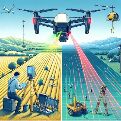
Aerial LiDAR works by emitting laser light
pulses from a sensor mounted on an aircraft or drone. These laser pulses then
bounce back after hitting objects or surfaces, and the sensor measures the time
it takes for the pulses to return. By calculating the speed of light, the
system can accurately determine the distance between the sensor and the target,
creating a point cloud of millions of data points.
This point cloud data can then be processed to
generate highly accurate 3D models of landscapes, buildings, and other
structures. Aerial LiDAR also captures additional information such as intensity
values, which can be used to identify different materials or objects. This data
can be further analyzed and combined with other datasets to extract valuable
insights and make informed decisions.
Aerial LiDAR systems typically consist of a
laser scanner, an Inertial Measurement Unit (IMU) for measuring the position
and orientation of the sensor, a Global Navigation Satellite System (GNSS) for
georeferencing the data, and a data storage and processing unit. These
components work together seamlessly to capture and process the LiDAR data
accurately and efficiently.
Applications of Aerial LiDAR Mapping
The applications of aerial LiDAR mapping are
vast and diverse, spanning across various industries. One of the most
significant applications is in urban planning and development. Aerial LiDAR
allows city planners to accurately map and analyze the existing urban
landscape, including buildings, roads, and infrastructure. This data helps in
making informed decisions regarding urban expansion, traffic management, and
infrastructure development.
Forestry management is another area where
aerial LiDAR plays a crucial role. By capturing detailed information about tree
height, canopy density, and biomass, aerial LiDAR enables forest managers to
assess the health of forests, identify areas prone to wildfires, and plan for
sustainable logging practices. This data can also be used to monitor changes in
vegetation over time and evaluate the impact of climate change on forest
ecosystems.
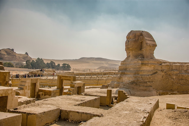
Archaeology is yet another field where aerial
LiDAR has proven to be invaluable. By scanning large areas from above, LiDAR
can reveal hidden archaeological features such as ancient structures, burial
sites, and even ancient road networks. This non-invasive method of mapping
allows archaeologists to identify potential excavation sites and plan their
research more efficiently.
Infrastructure development and maintenance also benefit greatly from aerial LiDAR mapping. By capturing highly accurate topographic data, LiDAR helps engineers and planners design and monitor infrastructure projects such as roads, bridges, and pipelines. It enables them to identify potential hazards, optimize routes, and ensure the structural integrity of existing infrastructure.
Advantages Of Using Aerial LiDAR For Mapping
The advantages of using aerial LiDAR for
mapping are numerous and significant. One of the key advantages is the
unparalleled accuracy and detail it provides. By capturing millions of data
points per second, aerial LiDAR creates highly accurate 3D models that can be
used for precise measurements, volumetric analysis, and visualization.
Another advantage is the speed and efficiency
of data collection. Traditional mapping methods can be time-consuming and
labor-intensive, requiring ground-based surveys or manual measurements. Aerial
LiDAR, on the other hand, can cover large areas quickly and capture data from
difficult-to-reach locations. This saves time and resources, allowing
professionals to make informed decisions and streamline their processes.
Cost savings are also a major advantage of
aerial LiDAR mapping. Traditional mapping methods often require extensive
fieldwork, equipment, and manpower. Aerial LiDAR reduces the need for
on-the-ground surveys, minimizing costs associated with personnel, logistics,
and equipment. It also eliminates the risk of human error, ensuring the
accuracy and consistency of the data.
Furthermore, aerial LiDAR provides a
non-intrusive and non-destructive method of mapping. It allows for mapping
large areas without the need for physical access or disturbance to the terrain.
This is particularly beneficial in environmentally sensitive areas or areas
with cultural heritage sites.
Aerial LiDAR vs. Traditional Mapping Methods
Aerial LiDAR has several advantages over
traditional mapping methods. One of the key differences lies in the level of
detail and accuracy. Traditional mapping methods often rely on ground-based
surveys or manual measurements, which can be prone to errors and limitations.
Aerial LiDAR, on the other hand, captures millions of data points per second,
resulting in highly accurate and detailed 3D models.
Another significant difference is the speed
and efficiency of data collection. Traditional mapping methods can be
time-consuming and labor-intensive, requiring extensive fieldwork. Aerial
LiDAR, on the other hand, can cover large areas quickly and capture data from
difficult-to-reach locations, saving time and resources.
Cost savings are also a major advantage of
aerial LiDAR mapping. Traditional mapping methods often require extensive
fieldwork, equipment, and manpower. Aerial LiDAR reduces the need for
on-the-ground surveys, minimizing costs associated with personnel, logistics,
and equipment.
Furthermore, aerial LiDAR provides a
non-intrusive and non-destructive method of mapping. It allows for mapping
large areas without the need for physical access or disturbance to the terrain.
This is particularly beneficial in environmentally sensitive areas or areas
with cultural heritage sites.
While traditional mapping methods still have
their place in certain applications, aerial LiDAR offers unmatched accuracy,
efficiency, and cost-effectiveness, making it the preferred choice for many
mapping projects.
Case Studies Showcasing The Power Of Aerial LiDAR
1. Urban Planning And Development
In the field of urban planning, aerial LiDAR
has become an invaluable tool for creating detailed and precise 3D models of
cities and urban environments. Traditional mapping methods often relied on
ground surveys and manual measurements, which were time-consuming and prone to
errors. However, with aerial LiDAR, urban planners can now accurately capture
the shape and elevation of buildings, roads, and other structures from above,
allowing for more efficient and informed decision-making.
For example, in the city of Vancouver, Canada,
aerial LiDAR was used to create a comprehensive digital model of the urban
landscape. By accurately mapping the city's buildings, trees, and other
features, planners were able to simulate the impact of various development
scenarios, such as the construction of new high-rise buildings or the expansion
of transportation networks. This helped them assess factors like sunlight
exposure, wind patterns, and the potential for shadowing, leading to more
sustainable and well-designed urban spaces.
In addition to urban planning, aerial LiDAR is
also being used in disaster management and emergency response. By quickly
assessing the damage caused by natural disasters like earthquakes or floods,
authorities can make informed decisions about evacuation, search and rescue
operations, and infrastructure repair. The detailed 3D models created by aerial
LiDAR allow for more accurate damage assessments and help prioritize recovery
efforts.
2. Forestry And Environmental Analysis
Aerial LiDAR has also proven to be a
game-changer in the field of forestry and environmental analysis. By accurately
measuring vegetation density, canopy height, and tree species distribution,
this technology enables researchers and environmentalists to monitor and manage
forests more effectively.
In the Pacific Northwest region of the United
States, aerial LiDAR was used to assess the health and productivity of
commercial forests. By creating detailed 3D models of the forest canopy,
researchers were able to identify areas of high tree density and evaluate the
potential for timber harvesting. This information allowed them to make more
informed decisions about sustainable forest management practices and optimize
the yield from timber resources.
Furthermore, aerial LiDAR can also help in
assessing the impact of climate change on forests and other ecosystems. By
comparing LiDAR data collected over multiple years, researchers can identify
changes in vegetation patterns, tree mortality rates, and the overall health of
ecosystems. This information is crucial for understanding the long-term effects
of climate change and developing strategies to mitigate its impact.
3. Archaeology And Cultural Heritage Preservation
Aerial LiDAR has revolutionized the field of
archaeology by providing new insights into ancient landscapes and structures.
Traditional archaeological surveys often relied on ground-based methods like
excavation and surface mapping, which were time-consuming and limited in scope.
However, aerial LiDAR allows archaeologists to quickly and accurately capture
the topography of large areas, revealing hidden archaeological features and
structures that would otherwise go unnoticed.
One remarkable example of aerial LiDAR's
impact on archaeology is the discovery of the ancient Maya civilization in the
dense jungles of Central America. By using LiDAR technology to penetrate the
thick vegetation, researchers uncovered thousands of previously unknown Maya
structures, including pyramids, temples, and irrigation systems. This
breakthrough has significantly expanded our understanding of the Maya
civilization and its sophisticated urban planning and agricultural practices.
Aerial LiDAR is also playing a crucial role in
cultural heritage preservation. By creating detailed 3D models of historical
sites and monuments, this technology allows for accurate documentation and
virtual preservation of cultural treasures. In the event of natural disasters,
armed conflicts, or deterioration due to time, these virtual models serve as a
valuable resource for restoration and reconstruction efforts, ensuring that our
cultural heritage is preserved for future generations.
Future Trends In Aerial LiDAR Technology
As the demand for aerial LiDAR continues to
grow, researchers and engineers are constantly pushing the boundaries of this
technology to unlock new capabilities and applications. Here are some of the
future trends we can expect to see in aerial LiDAR technology:
1. Miniaturization And Integration
One of the key areas of focus in aerial LiDAR
technology is miniaturization and integration. As the technology becomes more
compact and lightweight, it can be easily integrated into unmanned aerial
vehicles (UAVs) or drones, allowing for more flexible and cost-effective data
collection. Miniaturized LiDAR sensors will enable the mapping of hard-to-reach
areas, such as dense forests or rugged terrains, with greater ease and
efficiency.
2. Improved Data Processing And Analysis
Another area of advancement in aerial LiDAR is
in data processing and analysis. As the technology continues to capture
increasingly large volumes of data, there is a need for more efficient
algorithms and software tools to process and extract meaningful information
from the raw LiDAR data. Machine learning and artificial intelligence
techniques will play a crucial role in automating data analysis, enabling
faster and more accurate interpretation of the captured information.
3. Fusion With Other Sensing Technologies
In the future, we can expect to see the fusion
of aerial LiDAR with other sensing technologies, such as hyperspectral imaging
or thermal cameras, to enhance the capabilities of data collection and
analysis. By combining LiDAR data with other types of remote sensing data,
researchers and professionals will be able to gain a more comprehensive
understanding of the studied areas, enabling more informed decision-making in
various fields, including agriculture, environmental monitoring, and
infrastructure development.
Conclusion
Aerial LiDAR has revolutionized the way we map
and understand our world from above. With its ability to capture millions of
data points per second, this technology provides unparalleled accuracy and
detail in mapping terrains, objects, and structures. From urban planning and
forestry to archaeology and cultural heritage preservation, aerial LiDAR has
transformed various industries, enabling professionals to make informed
decisions, streamline processes, and enhance project outcomes.
As technology continues to advance, we can
expect to see further improvements in aerial LiDAR, including miniaturization,
improved data processing, and fusion with other sensing technologies. These
advancements will open up new possibilities for mapping and understanding our
world, ensuring that aerial LiDAR continues to soar to new heights. So, let us
embrace the power of aerial LiDAR and unlock the unlimited potential it holds
in mapping the world from above.


Comments
Post a Comment